CAISAR Live Map
What's Happening, Anywhere, Right Now
We built the Live Map as a free tool for up-to-date information worldwide. It puts weather alerts, wildfires, earthquakes, floods, road closures, air quality, infrastructure and world events on one screen, refreshed from official sources as they publish, so teams, agencies and the public can see a situation as it develops.
Launch the Live Map Free to use, no sign-in needed. Opens map.caisar.org in a new window.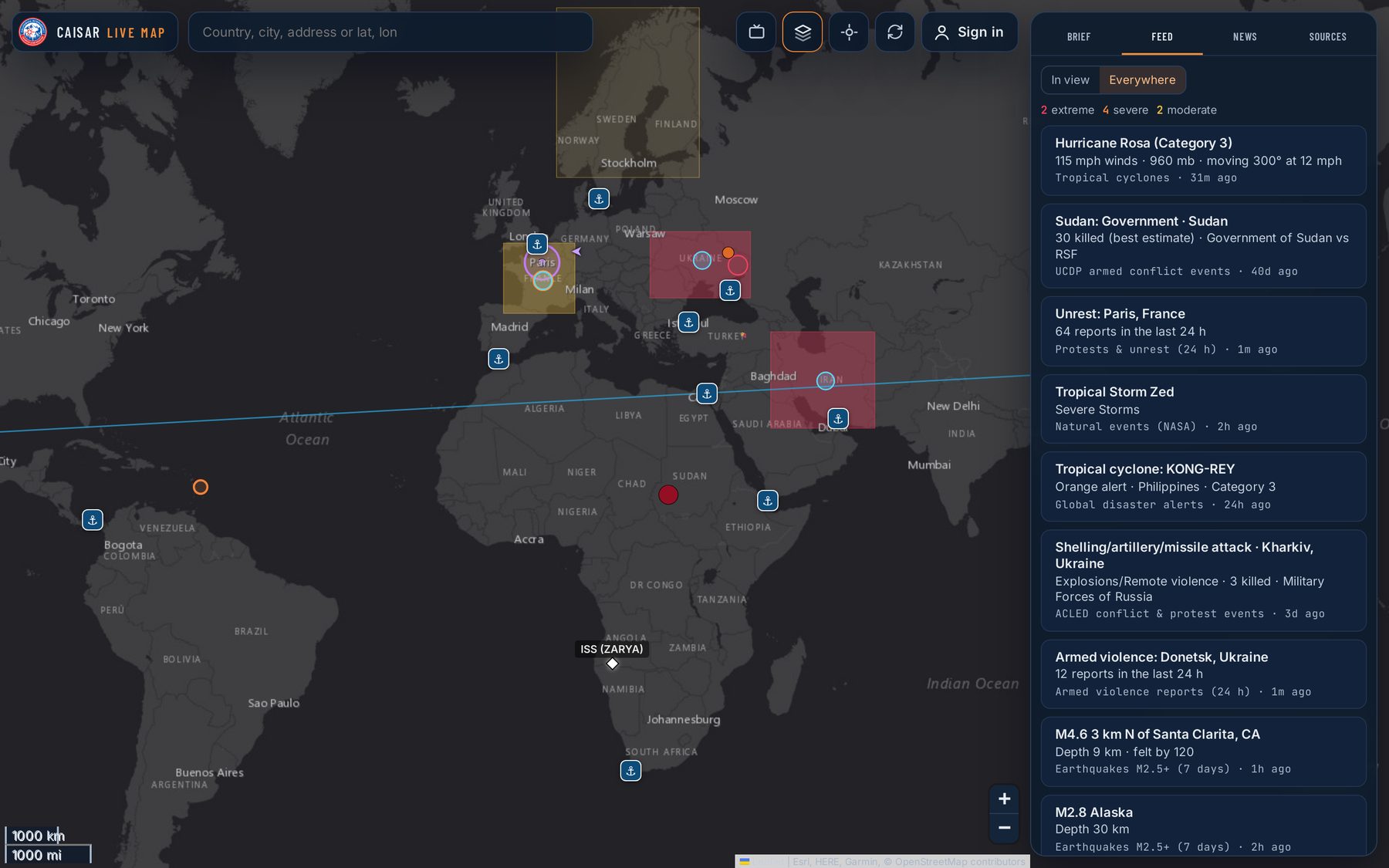
What It Does
Built for Up-to-the-Minute Awareness
Live Feed
Every alert and event in view, ranked from extreme to minor, with a switch to see everywhere at once.
Brief Anywhere
Tap any spot for coordinates (including MGRS), the land manager, fire hazard zones and every hazard within 25 miles.
Three Lenses
One tap switches the map for the question at hand: Prepare, Geopolitics or Infrastructure.
Country Profiles & News
Country briefs drawn from the World Bank, UN and international newsrooms, with headlines mapped by country.
Live TV
22 official 24/7 news streams from around the world, sorted by region, up to four at a time.
Sources You Can Check
Every layer names its source and shows when it last updated. If a feed goes down, the map keeps the last good copy and marks it stale.
Search Planning Tools
For signed-in team members: search segments, routes and last-known-point rings, exported to GPX or KML.
Phone, Tablet or Desktop
Works in any browser, in light or dark mode, and can be embedded on partner websites.
A Closer Look
From a Single Trailhead to the Whole Planet
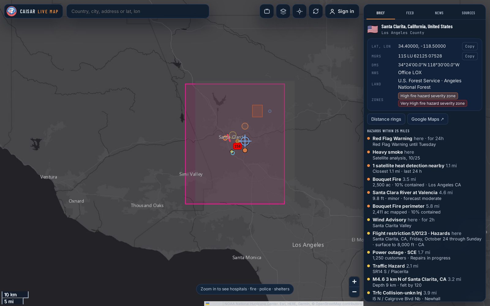
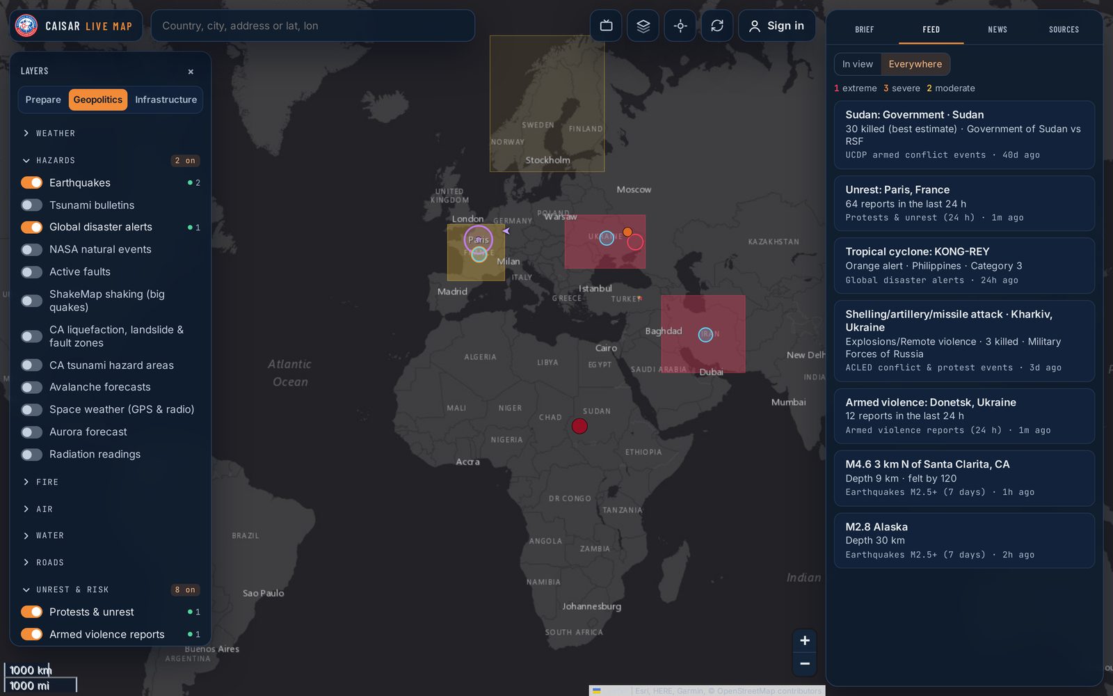
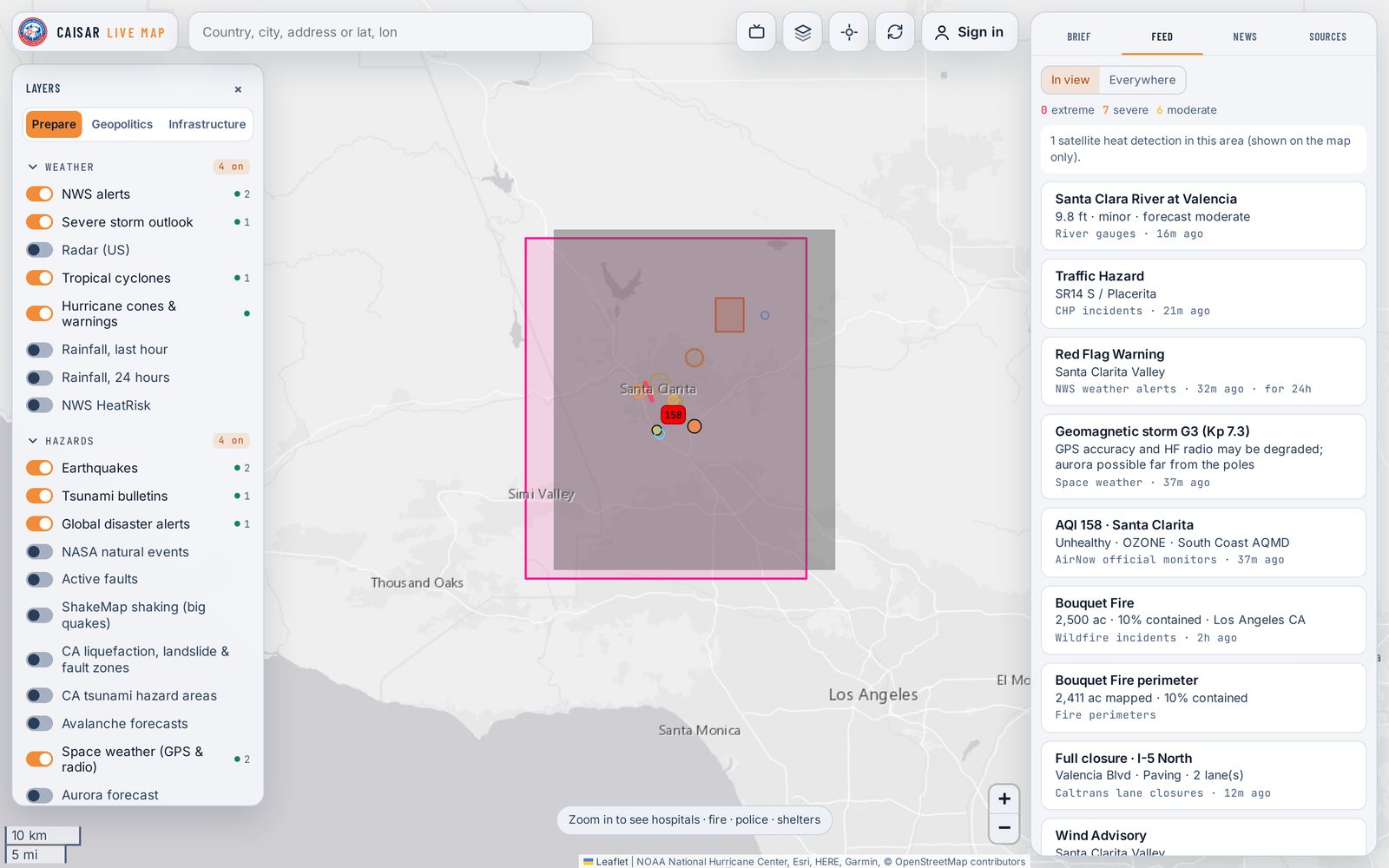
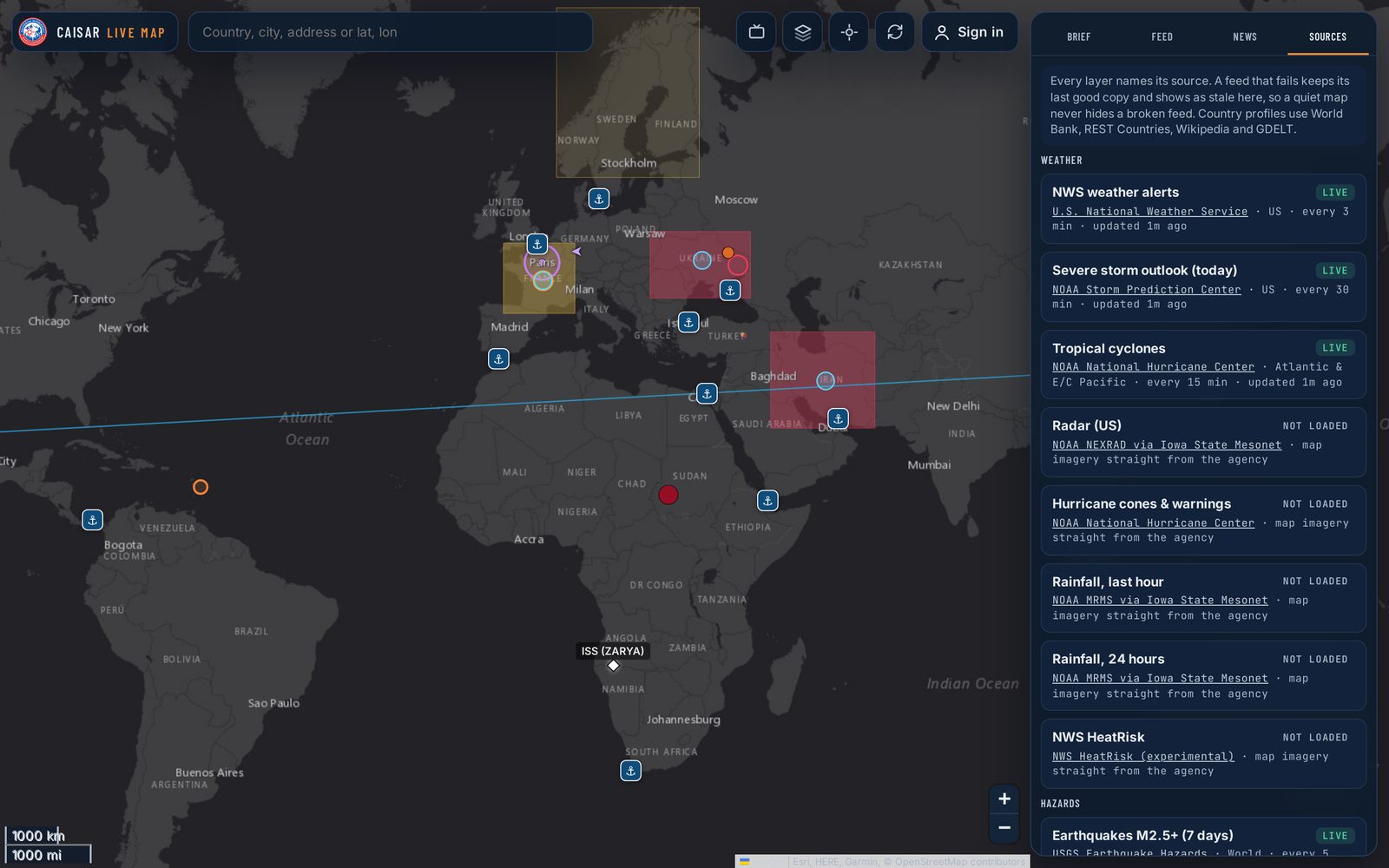
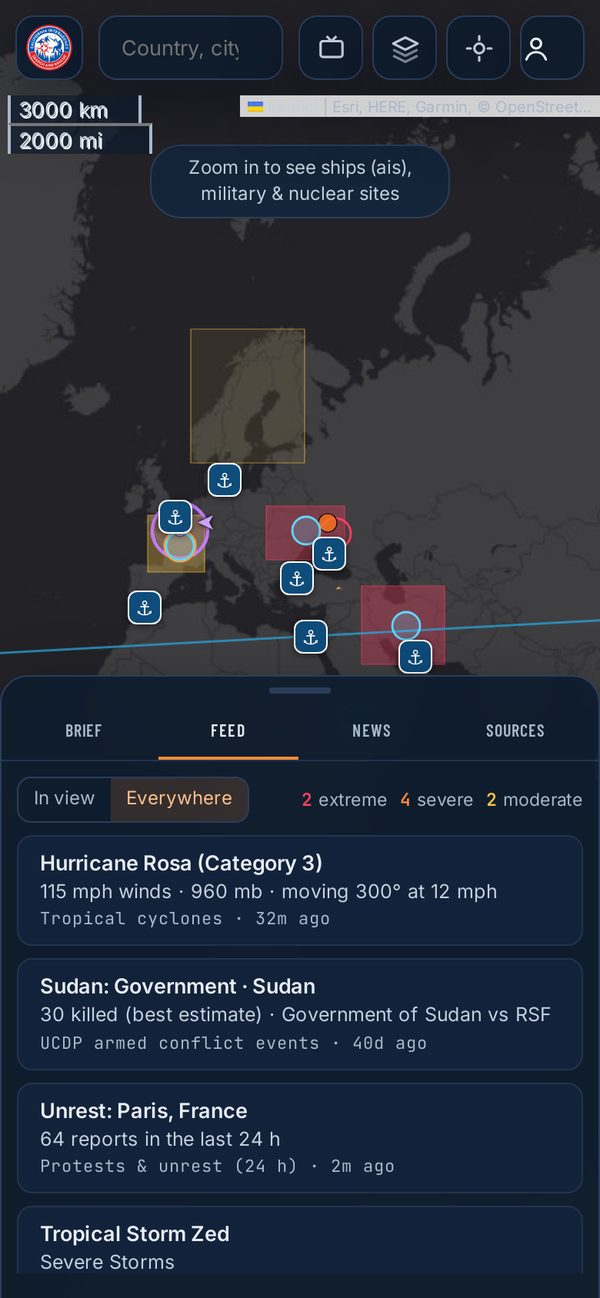
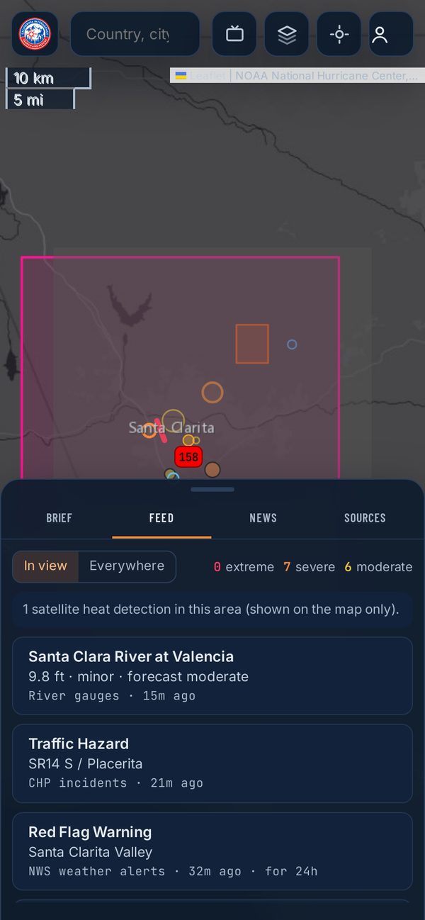
Screens from a test copy of the map with sample data. Open the live map for real-time information.
The Data Feeds
63 Layers From 60+ Sources
Almost every layer comes straight from the agency or research group that publishes it: NOAA, USGS, NASA, FEMA, CAL FIRE, Caltrans, the UN, the World Bank and many more. The map is stored on our server and refreshed on a schedule, so it stays quick for everyone without overloading the sources.
Weather
8 Layers- NWS AlertsNational Weather Service
- Severe Storm OutlookNOAA Storm Prediction Center
- Radar (US)NOAA NEXRAD via Iowa State Mesonet
- Tropical CyclonesNOAA National Hurricane Center
- Hurricane Cones & WarningsNOAA National Hurricane Center
- Rainfall, Last HourNOAA MRMS via Iowa State Mesonet
- Rainfall, 24 HoursNOAA MRMS via Iowa State Mesonet
- NWS HeatRiskNational Weather Service
Hazards
12 Layers- EarthquakesUSGS Earthquake Hazards
- Tsunami BulletinsNOAA Tsunami Warning Centers
- Global Disaster AlertsGDACS (UN / European Commission)
- NASA Natural EventsNASA EONET
- Active FaultsUSGS Quaternary Faults
- ShakeMap ShakingUSGS ShakeMap
- CA Liquefaction, Landslide & Fault ZonesCalifornia Geological Survey
- CA Tsunami Hazard AreasCalifornia Geological Survey
- Avalanche Forecastsavalanche.org
- Space Weather (GPS & radio)NOAA Space Weather Prediction Center
- Aurora ForecastNOAA Space Weather Prediction Center
- Radiation ReadingsSafecast
Fire
4 Layers- Wildfire IncidentsNIFC WFIGS
- Fire PerimetersNIFC WFIGS
- Satellite Heat (24 h)NASA FIRMS
- Fire Hazard Severity ZonesCAL FIRE
Air
3 Layers- Wildfire SmokeNOAA Hazard Mapping System
- Air QualityEPA AirNow
- Air SensorsPurpleAir
Water
3 Layers- River GaugesNOAA National Water Prediction Service
- Flood ZonesFEMA National Flood Hazard Layer
- Drought MonitorU.S. Drought Monitor
Roads
3 Layers- Traffic IncidentsCalifornia Highway Patrol
- Lane & Road ClosuresCaltrans
- Chain ControlsCaltrans
Unrest & Risk
10 Layers- Protests & UnrestGDELT Project
- Armed Violence ReportsGDELT Project
- Verified Conflict EventsACLED
- Conflict EventsUppsala Conflict Data Program
- GPS Jamminggpsjam.org
- Disease & Health NoticesWHO, CDC
- News by CountryBBC, Al Jazeera, Guardian, DW, France 24, NPR, CBC, UN News, ReliefWeb
- Travel AdvisoriesU.S. State Department
- Political StabilityWorld Bank
- Internet DisruptionsIODA, Georgia Tech
Movement
7 Layers- Aircraftadsb.lol
- Military Aircraftadsb.lol
- Ships (AIS)AISStream
- Shipping ChokepointsBuilt into the map
- Flight Restrictions (TFR)FAA
- Airport Delays & ClosuresFAA
- SatellitesCelesTrak
Infrastructure
7 Layers- Undersea CablesTeleGeography
- Military & Nuclear SitesOpenStreetMap
- Hospitals, Fire, Police & SheltersOpenStreetMap
- Power Outages (CA)Cal OES and California utilities
- Power PlantsWorld Resources Institute
- DamsU.S. Army Corps of Engineers
- SeaportsNGA World Port Index
Cameras
2 Layers- Highway CamerasCaltrans
- Public WebcamsWindy
Planning
4 Layers- Disaster DeclarationsOpenFEMA
- Land OwnershipBureau of Land Management
- Cell Coverage by CarrierFCC National Broadband Map
- APRS Trackersaprs.fi
Also used: Open-Meteo weather, REST Countries, UNHCR, U.S. Treasury and UN sanctions lists, Polymarket and GDELT for country briefs; OpenStreetMap for place search; and Esri, Mapbox and the USGS National Map for base maps.
See It Live
Open the map, pick a lens, and zoom to anywhere on Earth. It's free, and there's nothing to install.
Launch the Live MapWant the map on your agency's or team's website? Ask Us About Embedding It.